
Time for some more serious hiking!
On the western side of the state of New Hampshire, in a section of the White Mountains near Waterville Valley (famous for its ski area,)from exit 28 on I-93, is a trail that climbs Welch and Dickey Mountain. Capped by sub-alpine plant life and fantastic exposed views, as well as being one of two locations in the state known for having Jack-Pines, this was the making of a fantastic hike.
Heading north on I-93 from Concord, NH, the weather was threatening disaster (much like it has for the northeast this summer this year). Grey clouds and light to moderate rains loomed ahead on the drive northward. Fortunately, as we neared the trail-head the sky seems to lighten up and in a few places there was actually blue sky. So, after pulling on my pack and prepping the dog, we headed up to the trail-head, and getting our bearings, began the ascent up the mountains.
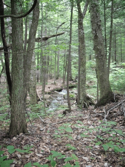
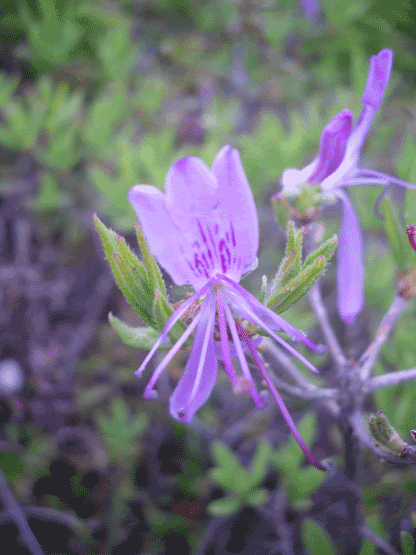
The trail starts in mixed deciduous and coniferous forest, and begins a moderate grade up the first peak. Bearing right in the fork of the trail, you begin your ascent up Welch Mountain. If you had visions of a light and easy hike at this point, you had better ditch those thoughts now as you begin a steep ascent for the tree line. This is the shortest bu most difficult section of the loop. As you approach what you first think is the top of the mountain within the first 1.2 miles of the hike, you break into a mix of jack pine and sub-alpine plant life. Surprising to me, on the exposed and sunny areas, Lady Slipper orchids (Cyprepidium acuale) were in full bloom, usually preferring the dappled shade of Hemlock, oak and birch trees).
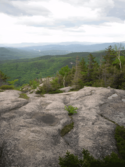
Thus begins the exposed section as you follow the yellow blazes on a series of ledges, many of which are at a steep incline. The trail seemingly disappears often as you climb up a ledge, only to discover that the trail keeps going up. My ten month old Shiba Inu pup, Nori, lived up to the Japanese meaning of her breed Mountain Dog as she nimbly jumped up four foot high ledges and waited impatiently for her dada to follow her up.
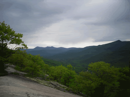
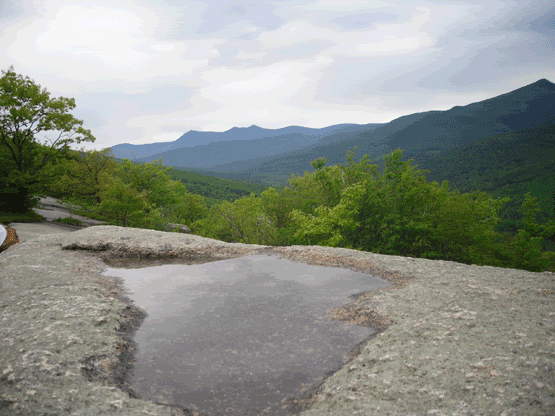
We finally reached the top of Welch Mountain, and the vistas of the surrounding mountains were fantastic! Here the trail continues on to Dickey Mountain. Descending from the top of Welch brought my first and only heart-in-the-throat moment when, following the yellow blazes, the trail seemingly dropped off of a vertical cliff edge. Gingerly working my way to the drop off while trying to keep Nori from running up ahead of me to her possible demise, I saw that the blazes lead you to the left, down an easy four foot climb. Descending this, we re-entered the forest as we walked .6 miles or so in the saddle between the two peaks.
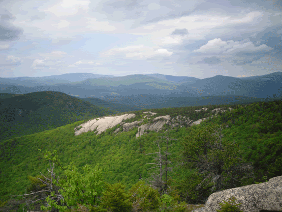
Leaving the forest in the saddle behind, we started ascending a few more ledges to the peak of Dickey Mountain, which offers a 360° view of the entire area. From the peak of Dickey you can see Franconia Notch and Franconia Ridge to the north.
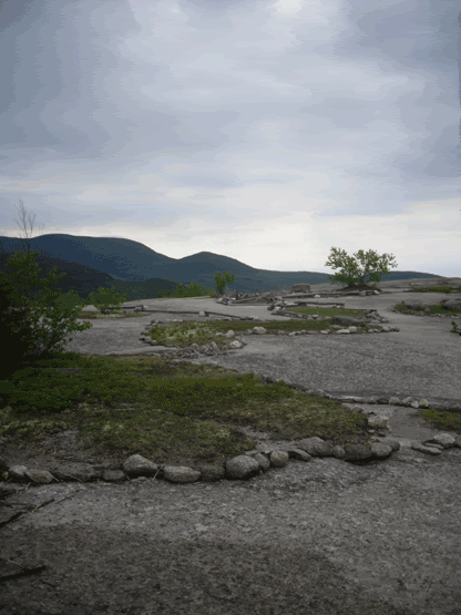
On the descent, however, I fond my favourite part of the entire hike. You begin a series of exposed ridge-walks with precipitous drop-offs on either side. The going is very steep so I recommend going slowly. There are also a series of cairns that help point out the direction you are supposed to go. Stopping occasionally to add a stone or two to the cairns helps to maintain them, however please to be conscientious not to dig up new stones, just pick up the ones that rain and wind and time has dislodged from the pile.
When you begin to reach the end of the hike, you return into the forest that you began. Nori was getting tired and rambunctious like a cranky three-year old and had to be picked up and carried, but she did very well for her first long-ish and difficult hike. Upon our arrival back at the parking lot, the sky opened up and began to rain again (perfect timing though I felt bad for the people still on the trail).

The complete distance for the Welch-Dickey Loop Trail is 4.4 miles, and can typically be done in about five hours. The trail is fairly steep in quite a few places, so please be sure to have decent and supportive foot-wear as you will be spending quite a bit of your time on the balls of your feet. This is a fairly popular hike, so if you plan on going, arrive early to assure a parking spot and if you want relative peace and quiet.
Directions:
From I-93:
* Take exit 28 off I-93, and head east toward Waterville Valley on Rt. 49.
* Turn left onto Mad River Road (at the traffic signal) and bear right when Mad River Road goes that way.
* Then turn right onto Upper Mad River Road, which is both paved and dirt.
* Turn left onto Orris Road (there is a hiker sign at this intersection).
* Follow Orris Road for 0.6 mile and then take a short fork to the right to reach a large parking area.
* The Welch-Dickey Loop trail starts from the upper end of this parking area and quickly forks with the left branch leading most directly to Dickey Mountain and the right leg first encountering Welch Mountain.

No comments:
Post a Comment