Monday, October 17, 2011

Where the Sidewalk Really Ends


Shel Silverstein (author of the book Where the Sidewalk Ends) likely didn't know of the existence of the town of Hill, nestled next to the Pemigewasset River (or as we just call is here in NH, "the Pemi") near Plymouth, New Hampshire, nor would he have known that there really are sidewalks that just end...and lead to nowhere.


This was not always the case with the town of Hill.  First, if you look at a map the town of Hill still exists now at a safe distance above the Pemi.  This region of New Hampshire was once, and still occasionally is, affected by floods especially in the Spring during the snow-melt from the White Mountains.  These floods had devestating effects on the small town of Hill.  Founded in 1753 under the name of New Chester the name was changed  to Hill in 1837 in honor of Isaac Hill, NH governor from 1836 to 1839. 

In 1941 a new dam was constructed near Franklin, NH in an attempt to alleviate the flooding issue that had plagued the area.  This was when the entire town, including buildings and graves, were relocated to higher ground.


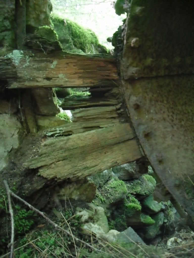
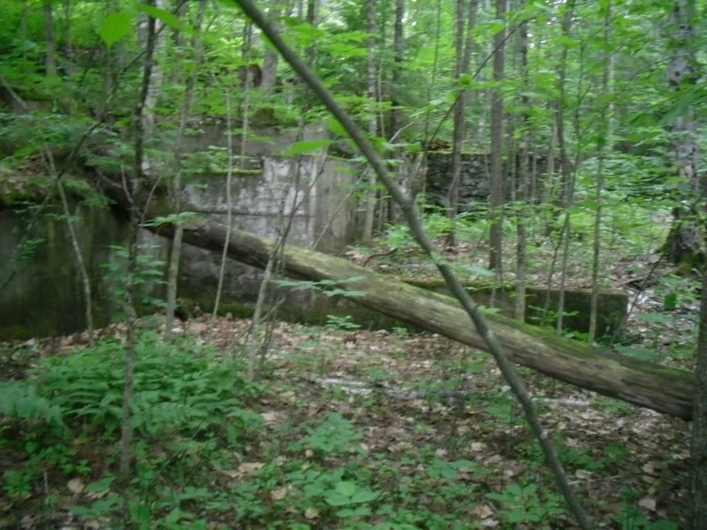
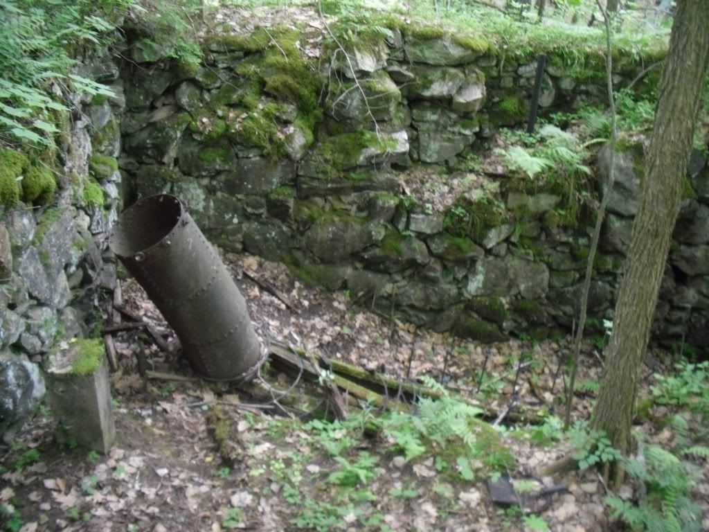
From the parking area on Old Town Road, Shop Road enters the woods following a swift flowing brook on the left.  Here is where your first structures are encountered, the remains of an old mill with a marker nearby showing the various flood levels that used to plague the area.  The most apparent remains of the mill will be some concrete walls and the penstock on the brook side of the road, but the main ruins are easily missed on your way down.  There are several paths that lead you into the larger ruin complex which is very impressive!


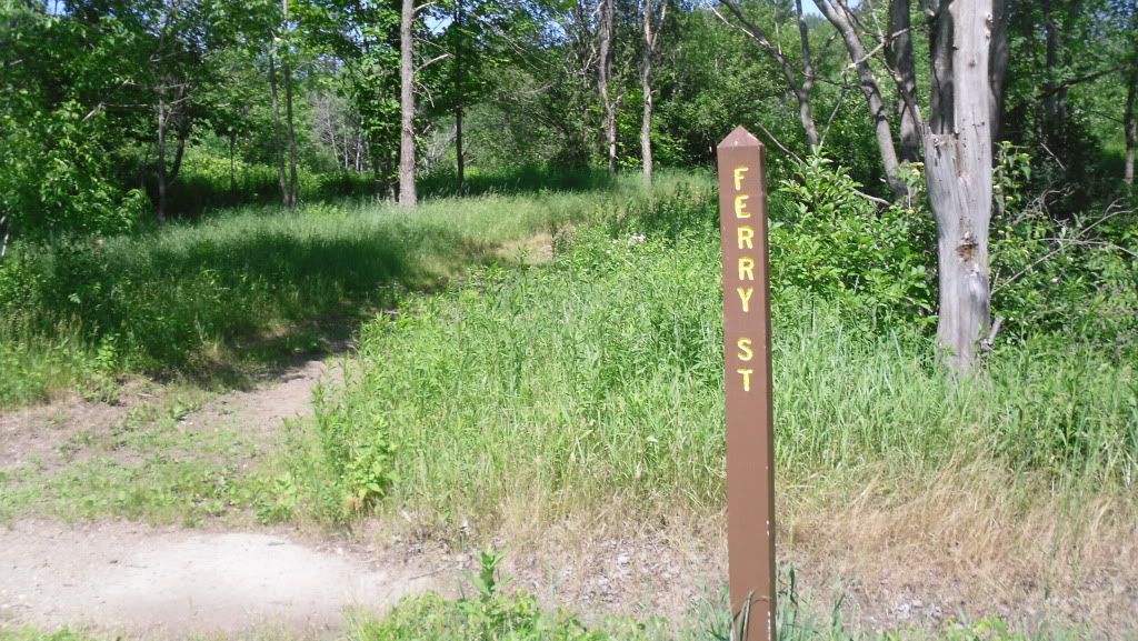
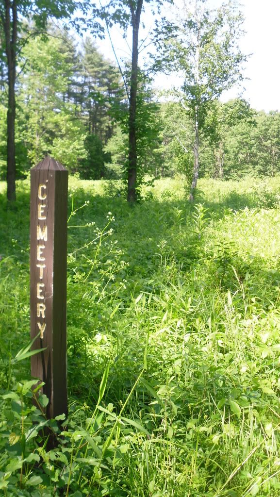
Shop Road ends at the bottom of the hill on the broad flood plain on which the town was originally constructed.  Here you reach the main street of the town, Center Hill Road, and the road T's heading north (to the left) and south (to the right).  On this particular trip we went north where there are broad open lots, a few posts telling you the name of the old streets and open lots.  Just after crossing the bridge, Ferry St begins on the right, and following this narrow path you will eventually reach the old cemetery with fields of poison ivy everywhere.  There aren't any graves left, or at least that we could see.  Ferry Road ends and another unnamed road travels parallel with the river.


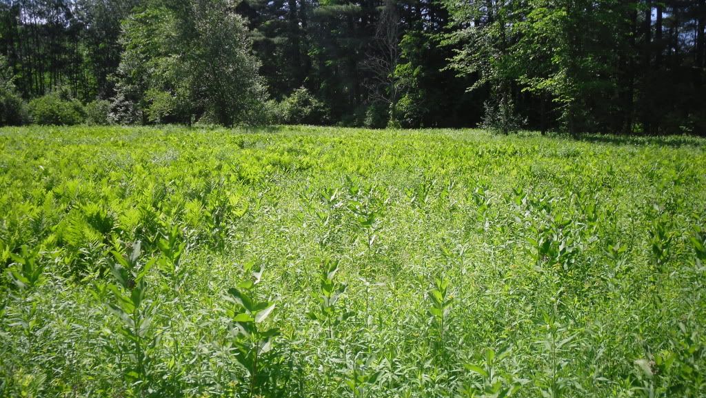
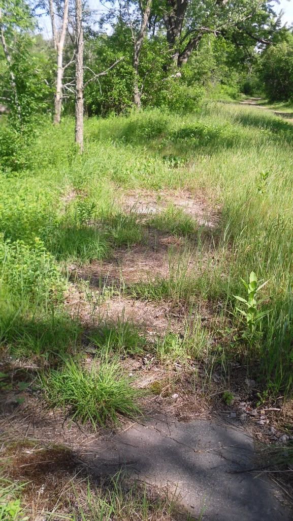
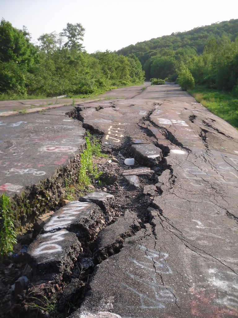
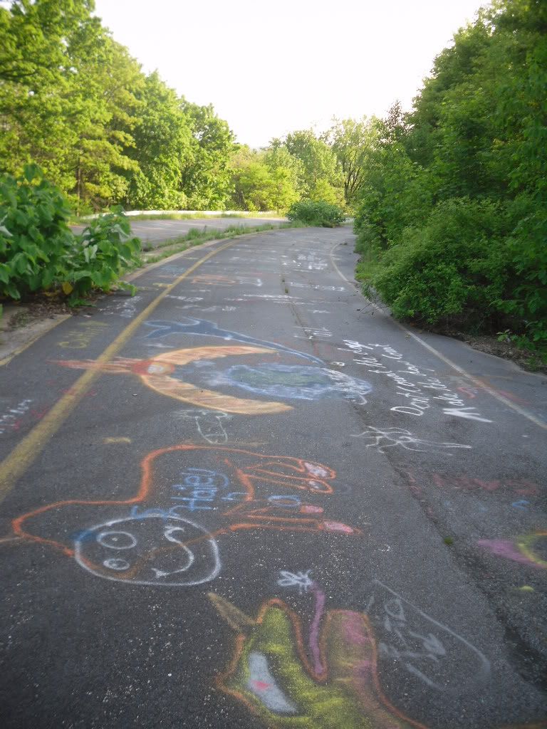
Back on Center Hill Road and traveling north you will pass by the old lot that the school sat on, the only evidence of it being there is a concrete pad near some trees, and on the right side of Center Hill Rd are the old sidewalks that peek out from beneath leaves, wild strawberries, poison ivy and dirt that has slowly taken everything over.


Eventually the road exits the town and re-enters the woods and on the right it a sign that simply states "The Eddy" and a path.  This leads you down to a sheltered lagoon on the Pemi and some really nice rocks to stretch out on, soak up some sun and silence.

Unfortunately we ran out of time to explore the southern end of Center Hill Road, but evidently this is where the majority of the foundations are found.  We will be making a return trip to explore this part when the poison ivy is a little less threatening.

Old Hill directions:
  • Take I-93 North to Exit 20, Rt 3
  • Bear west toward Rt 3A
  • Bear North on Rt 3A into Hill
  • After passing the post office (on right, very easy to miss), continue for about a mile to Old Town Road.
  • Turn right and you will pass a cemetery on the left and park in the parking area at the entrance of the Nature area.  Shop road begins at the gate.
Sturdy shoes are recommended as are long pants due to the area wide presence of poison ivy.  Trash and restroom facilities are not available, and this site is suitable to bring children.

Fire Will Attract More Attention than Any Cry for Help


In the case of the town of Centralia, Pennsylvania these words could not have rang more true.  Pennsylvania is renowned for many things: rolling farmland, the Amish, our nation's capital at one time was Philadelphia, Scranton is the setting of television series The Office, notoriously bad roads and coal...and a lot of it.


Located near the centre of the state, Centralia started out at the Roaring Creek Township in 1841, later renamed Centralia after it was determined that the name Centerville had already been taken, and was a busy coal mining town that had at one time over 2,000 souls in its heyday but this all began to change in the 1960's when the coal industry began to fail.   It was during this time that the true tragedy, not only in ecological impact but also upon the town and its people began to take shape.  It is unknown how the fires began.  One theory states that it was from the ashes of a coal burner that were thoughtlessly tossed into a hole in the ground.  Another places the blame upon a haphazard trash burning that took place in an improperly lined surface mine pit.  Whichever the case may be, the fire spread into the abandoned coal mines beneath the small town of Centralia in the 1960's and it has been burning ever since.


Media attention grew when a gas station owner noticed that the stick he used to measure the fuel level in his tank was abnormally hot, and after fetching a thermometer he found that the gasoline in his tank was an alarming 172° F (77.8° C).  Even the ground began to literally fall away beneath their feet when in the early 1980's a boy fell into a sink-hole four feet wide by one-hundred and fifty-feet (the young man did survive thanks to the quick thinking of his cousin).  In 1992 Eminent Domain was declared by Governor Bob Casey, in 2002 the United States Postal Service revoked the town's zip-code and formal evictions (or evacuations depending on whether or not you were a resident) in 2009.

The town just simply ceased to be...almost.


It is still possible to visit the town of Centralia, but what you see now is a slowly decaying town that has very few buildings, warning signs posted and a small hand full of very resolute residents who are trying to hold on to the homes that they have.  The town has gained a certain cult-status thanks to news paper articles, a few mentions on television shows, and it even was a source of inspiration for the fictitious hamlet of Silent Hill, but all one will find is a cemetery, steam fuming from holes in the ground and the twisted remains of PA Route 61 covered with lurid graffiti which to me is the saddest monument to the memory of this town.


The directions that I will post are from I-81 South as this is the direction I came.  I will just mention a few things ahead of time.  Roaming around the town could be literally hazardous to your health.  Coal off-gasses a lovely cocktail of carbon dioxide, carbon monoxide, hydrogen sulfide and many other things.  The ground is subject to shifting as mines collapse.  The old structures that do remain (as there are not many since they are slowly being bulldozed) should not be entered as they may be structurally unstable or could trap potentially deadly gasses. Anything you do here is at your own risk.  And yes, I will admit that this is something impressive to see, but please please please respect those who have chosen to stay here.  It is a very sensitive and sad situation.  And please do not remove any material from the site.  

Directions from I-81 South:

-Take Exit 124B and merge onto PA Route 61 toward Frackville
-Turn Left on N PA 61
-Follow this until you reach the center of the town of Centralia.  Parking can be made at the bottom of the hill from the cemetery.