Thursday, November 26, 2015

My new home

Not so much a story here, just thought that since I haven't posted anything in a couple years that I might type away on the virtual keyboard and show a few pictures of my exploration of my new home of Maine.  Actual stories will follow, but in the meantime here are some photos of exploring Penobscot Bay.


Monday, March 11, 2013

Tahawus Tract, NY


Deep in the wilderness of the eastern Adirondacks of New York was a small mining town that has gone by several names: McIntyre, Adirondac and Tahawus.  It was once a major site for iron mining and smelting, the old McIntyre blast furnace built in 1854 still standing testament to the existence of the industry.  The iron ore deposits were discovered in 1826 by Archibald McIntyre and what was later dubbed the Upper Works was mined for the ore until the mid 1800s.  A strange impurity was found in the iron ore that made the task of smelting the iron rather difficult for the technology of the time and finally the mines closed, the people left and the town fell to the wilderness.  However, lumber was a lucrative business on the foothills of Mt. Marcy and abundant game brought sport hunters.  Later named the Tahawus Tract, the private hunting club leased and managed the land from the miner's heirs. Photo of the McIntyre blast furnace from www.clearwater.org

In the 1940's technological breakthroughs rekindled the mining industry in the Tahawus Tract when the previously mysterious mineral called titanium could be processed.  National Lead Industries continued working the mine until 1989, the rough estimate of the titanium mined in the neighbourhood of 40 million tons.

I was attending the Fall NRO (Northeastern Regional Organization of the National Speleological Society) gathering at Natural Bridge and Caverns in the southern Adirondacks.  Even though I attended college in Vermont, just a spitting distance from the New York border I had always concentrated my efforts close to campus.  So after an enjoyable weekend of caving was getting ready to head home when someone had mentioned the local "ghost town".  was immediately interested and postponed the five hour drive back to the seacoast of New Hampshire.

After some Googling, I found some vague directions to "Tahawus" and some photos.  Tom, Dave and Ramon decided that they were going to head back to the Boston area instead and  I set off..  It took us a little bit of driving in circles since GPS signal in the area is not reliable and I didn't have a map, but finally when I spotted Upper Works Road and was heading for the access to Mt. Marcy, I knew it was the right path.

As I was heading up the road I spotted the old McIntyre Blast Furnace and stopped at the turn off.  Several trails lead around to the base of the structure.  The furnace is covered by a glass structure and there are piles of brick stacked neatly nearby.  Evidently there had been some restoration work done to stabilize the furnace.  On the backside, the one that faces the Hudson River there is an opening into the chimney.  I took the time to crawl in through the opening and shot a few pictures looking straight up the stack.  There are the remains of the duct-work where air would be blown into the heart of the furnace where a combination of powdered limestone or marble would be added to the iron ore to burn out the impurities.  There are also the foundations for more machinery closer to the river.

After exploring the blast furnace I continued down Upper Works Road and eventually passed several buildings, one of which is preserved very well and had a sign indicating that Theodore Roosevelt was staying in the village of Tahawus in 1901 with his family when a ranger rode out to inform him that then President William McKinley was in critical condition.  Roosevelt, upon arriving in Buffalo, learned that William McKinley died and later took the oath of office.

Further up the road I started passing more buildings, these in not so great shape.  Time and flooding had taken its toll and the buildings were in a severe state of decay.  I parked along the side of the road as this was its end and is the trailhead for Mt. Marcy and the surrounding peaks.


Starting down a faint footpath the first structure I found was the Pump House.  The roof is long gone, the machinery now silent.  I explored this and the surrounding houses, all of which are not structurally sound in the least and great care was necessary to make sure that I didn't bump into anything that could cause a floor to collapse from above.  I toured the area for about another hour before having to start my now six hour drive back to NH.

Click on the gallery below for larger images of the furnace and other structures of Tahawus Village


The part that I visited is the part that is publicly accessible.  The mines themselves are not and remain the property of National Lead Industries.  The old mine pits are not visible from the road as there is a pile of tailings that obscure them on the opposite side of the river from Upper Works Road.

A little more about the history of the area can be found at the Adirondack Park Agency's webpage.  This is a very easily accessible area due to the direct access road, but due to this it loses that "ghost town" feel.  However, it is still a great place to visit, perhaps on your way to hike up Mt.Marcy, the highest peak in New York State.  If you do decide to enter the buildings, it is at your own risk.  Be aware that the floors in most of the buildings are not stable and have collapsed through in many.  There is a lot of broken glass and rusting metal, so wear long pants and gloves are advisable to avoid getting cut.  There is very little evidence of vandalism which is nice to see, so please respect what remains and do not remove material from the site so others may enjoy.

Fort Dearborn and Battery Seaman


Compared to neighbouring Maine and Massachusetts, New Hampshire has only fourteen miles of coastline, the major port of the  area being in Portsmouth.  The deep waters of Portsmouth harbour makes for a superb location for the Portsmouth Naval Shipyard and its dedicated men and women who service military ships and submarines.  Because this was such a strategic point for our national defense, throughout history many forts have been built to protect these waters: Fort Constitution in New Castle, Fort McClary and Fort Foster to name a few.

On Odiorne Point, just south of Portsmouth is Fort Dearborn.  During WWI a temporary fire control station was constructed on Odiorne Point in 1917 for  Battery Hunter at Fort Stark, located on the nearby island of New Castle; a year later the temporary battery was removed.

With the arrival of WWII it was determined that our coastline was at risk of attack from the Germans and our strategic deep water ports must be protected.  The farmland of Odiorne Point was purchased and Fort Dearborn joined the ranks of other forts that ran from Maine to South Carolina as part of the Atlantic Seacoast Defense System.  The stretch that most people drive to get a view of the scenic coastline and stately mansions of Rt. 1A was shut down and only used by military personnel.  On April 18th, 1942 Battery 103, also known as Battery Seaman was constructed on Odiorne Point.  According to some research on the area the giant guns that were placed in the two casements of Battery Seaman were fired only once as a test and caused windows in nearby Portsmouth to shatter.  In 1948 the Battery was deactivated and in 1949 declared surplus property eventually coming into ownership of the state and later turned into Odiorne Point State Park. Photo from www,northamericanforts.com

 Several of these old buildings are still in existence, unknown to me until just over a year ago when my partner Heidi and I were talking about our mutual love of abandoned structures.  She had mentioned that her brother and a couple friends of his had actually gone inside of one of the casements (there are several still in existence, most are not accessible for clear and obvious reasons but they had gone inside of Battery Seaman to use as a setting for one of their amateur films).  I had been visiting Odiorne Point for several years and knew of the old foundations used for some guns but I never knew anything about the other structures.  A trip had to be made out to it!

Upon our arrival we took a trail that I had never been on before through the woods north of the visitors' center for the Seacoast Science Museum.  After turning down several trails we came to the first concrete structure.  This was a look-out or observation building of some sort.  It is currently covered in graffiti, some of it actually quite artistic though it is sad to see a piece of local military history treated like this.  Dee lead me on to another series of trails and soon in the distance the looming hulk of another concrete structure appeared.

This was one of the cannon casements of Battery Seaman itself.  Covered in artful graffiti as well and poetry, the scale of the structure is hard to discern as much of it resembles walking under an overpass with earth covering the majority of the structure.  In the tunnel itself are two cast iron doors, one of which has been covered in successive layers of plate steel that have been cut through by people attempting to get inside.  Though I poked my head through the gaping hole in the door I did not climb inside but did poke my camera through wherever I could to take photos.

I would save that for a later trip.  We found that on the backside of the Battery a trail leading to the top of the earthen mound and found another concrete structure on the top, evidently another lookout, that was covered in even more lurid graffiti warning people to "Beware of Hobos" (something that I now take to heart in my town as there is a shanty-town of homeless drug addicts that live near the old rail yard).  From the top of this hill are some additional trails, one leading you around a chain-link fence and takes you out onto the semi-circular concrete "roof" that the cannons were partially covered by.  Here we had found evidence in the form of PBR cans of either hipsters or someone with poor taste in beer having been there before us.  After returning to the bottom of this man-made hill we continued further north and came across the other casement of the second cannon.  Inside of the similar underpass type structure was another plate steel door, this one not forced open.  This was enough of a visit this time to wet my interest in finding out more about Battery Seaman and where it fit into the history of the area.

The brief account that I have given at the beginning of this episode of NET is the result of that research.  Reviewing images from Google Earth doesn't readily give you a sense of the old structures as many have been removed or buried.  Evidently the Command Centre of the Battery couldn't be housed in the Battery itself due to the vibration that would be caused by the guns.  I also eventually found a map of the interior of the casement structure which consisted of several rooms and a long tunnel that connected the two casements.  The Command Centre of the structure was located a distance away to the west of the Battery, something that we did not see on our initial visit to the area. Photo on left from www.northmericanforts.com showing the interior structure of the Battery Seaman.

Last year, just prior to our attempt to document and map the passageways of Howe's Caverns (See "How Cavers and a Commercial Cave Came Together to Help a Community") I purchased two slave units to fire flashes remotely for some cave photography, an admittedly difficult pursuit and needed to test them out ahead of time to get used to using them, and thought Battery Seaman would be the perfect environment to try them out.  So one day, shortly after work, Dee and I headed out to Odiorne Point and Battery Seaman (armed with a hiking pole to fend off attack by any of those aforementioned "Hobos").  The evening was very foggy with the arrival of Spring-like temperatures as we arrived at the sullen concrete colossus.  There were two other gentlemen there with a dog and flashlights poking there heads through the hole cut into the door, and after a brief exchange Dee and I climbed on in.


  The first thing that hits you is the smell. Not sour or rotten, but of decay...not really that pleasant.  The graffiti continues down the long corridor and there are piles of rubble and trash along the way.  Just  inside of the structure is the first of several rooms that you encounter.  Most do not have anything inside besides graffiti and some trash.


To go any further in trying to describe the interior of the structure would be an exercise in tedium.  There are very few artifacts that remain, the most major being the remains of some sort of machinery and duct-work.  However, it is still interesting historically and it has kindled my interest in finding out more about our abandoned military structures that dot our coastline and the neighbouring coast of Maine.  There is a lot of graffiti present throughout the entire site, while I do not condone adding graffiti to any site and will berate people that I see doing it, some of the artwork is very well done.  I plan on returning to this site with some higher powered flashes to get better shots.

As with ANY site such as this, enter at your own risk.  A dust mask would be a really good idea when visiting any of these military sites as you cannot be guaranteed that there are not any hazardous materials that could be inhaled (something that I thought long and hard about as I was walking around mask-less).  Also, be aware that these structures are antiquated and have not had any form of stabilization and you cannot be guaranteed that things will not collapse.  By entering any such structure you are assuming the risk.  And also, please do not deface the site any further than it already has.  This is a piece of our history that is slowly being lost either through decay or thoughtless defacement.


An update as of 03/09/2013

I finally located the Command Centre thanks to a wonderful iPhone app called Topo Maps (you can purchase it at www.topomapsapp.com)!  I did not enter the structure as I didn't come prepared to shoot with slave units and the tripod (it was a thirty minute hike in and out before the gates closed at the Seacoast Science Centre and it takes around fifteen minutes to get there from that entrance), but I will make the trip out there soon with the appropriate gear.  But there are a few photos to wet your appetite.


To find out more there are several high quality sites  to visit.  www.northamericanforts.com has been a great resource for the history, maps and the great image of the cannon firing.  Much more information can be found there.  Also http://pubpages.unh.edu/~kap289/pages/dearborn.html  is a great resource as well on some of the surrounding forts besides Fort Dearborn.  All photographs taken are by me with exception of the cannon photograph and the map of the interior of Battery Seaman.  Those rights remain with the owners of the American Forts website and have been used for illustrative purposes only.  And if the military bunkers are not quite your thing, the Seacoast Science Centre and the rest of Odiorne Point make for a great afternoon as well.


Wednesday, October 10, 2012

My Search for Floyd Collins


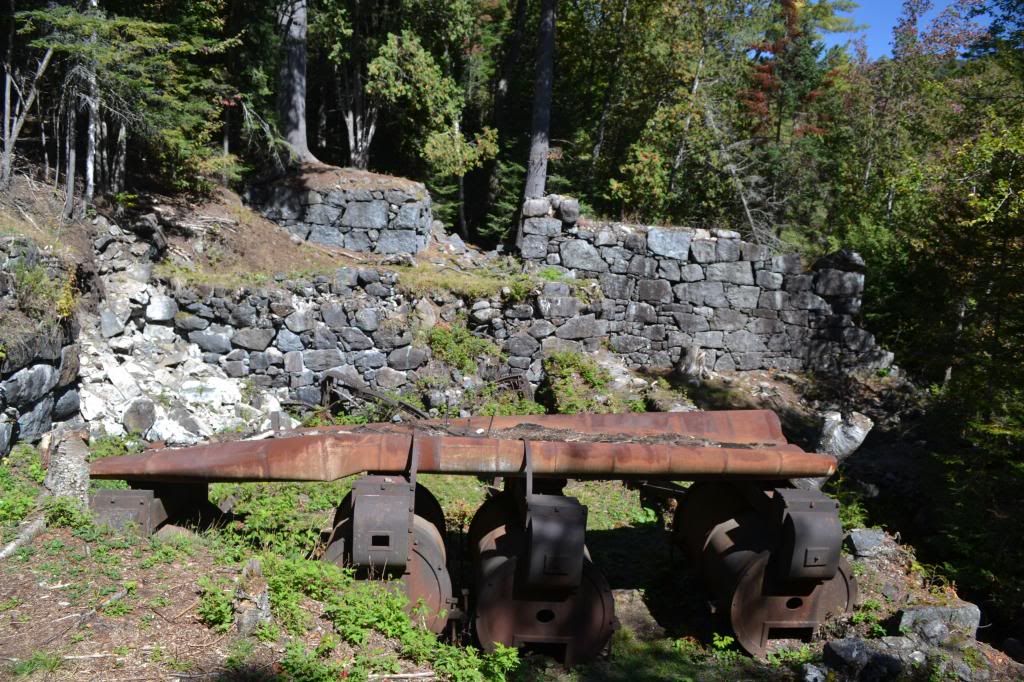
The gravel road, in itself, is very unremarkable.  It is unmarked as it branches away from Flint Ridge Road, and the gate is posted simply with "Do Not Block the Gate".  The temperature registered 106° F as we set off on foot, the car parked well out of the way of the gate.  The ice in my nalgene had already melted and the sun beat down cruelly...yup, this was going to be a long, hot walk.

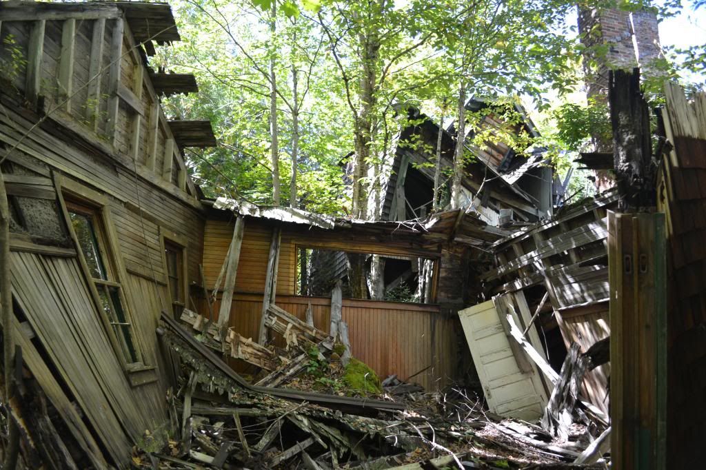
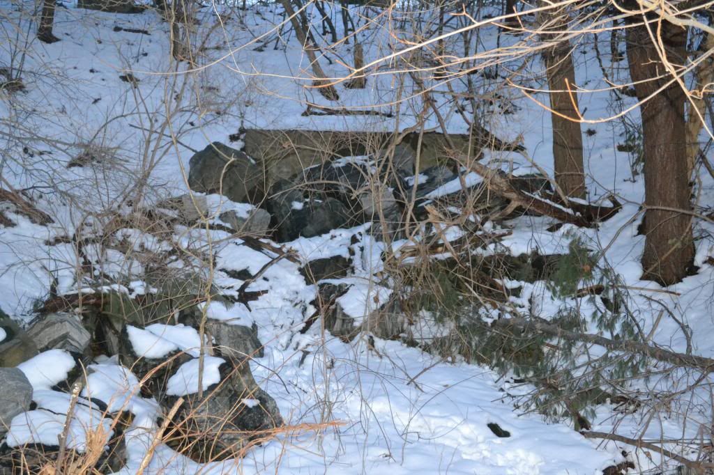
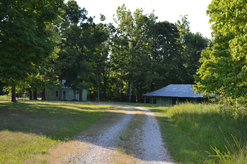
After about a mile and a bit of walking along the level road, two structures emerged in the grassy area in the woods and a broad smile wormed its way across my face.  "Well look at that, its the old ticket building and the old Collins' homestead!"  This is what I was hoping to see on this particular walk.  What brought us out here on the hottest day so far of the year to a rarely visited corner of the Mammoth Cave National Park in Kentucky? One man:  Floyd Collins.


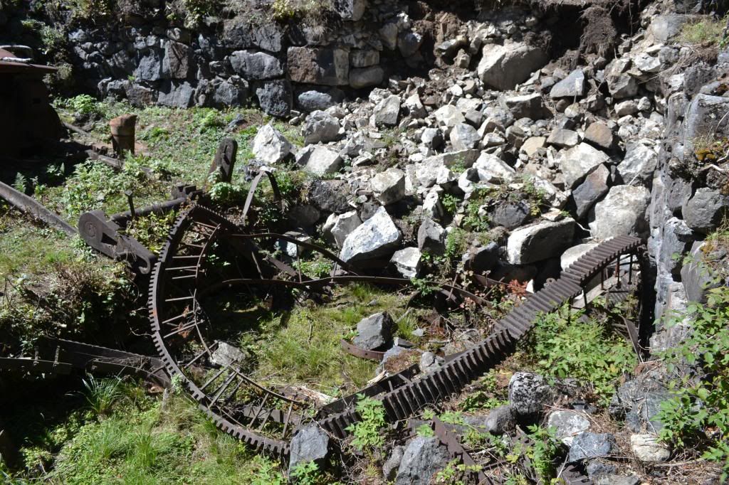
First, just a touch of history.  West Virginia, Ohio and Kentucky all sit on some pretty significant coal resources.  There is a saying that America was built on Pennsylvania Steel and West Virginia Coal.  The area of Central Kentucky is not one of these areas.  The land is mostly farm country, and as is typical of the limestone belt, its not the best farming.  The soil is poor and thin, however it does produce caves and mighty long ones at that.  Mammoth Cave had been a tour venture after the War of 1812 with the British and soon several other caves opened for the adventuresome tourist...and as a tourist back then you had to have a sense of adventure in order to travel out there.  The roads were in rough shape... accommodations were scant.  Eventually a train was put in that would stop at the various caves and a series of grand hotels were constructed at Mammoth.  The last cave on the road was Crystal Cave discovered by Floyd Collins.  Many of these caves competed bitterly among each other in order to bring in visitors, often a gentleman referred to as a "capper" would hop onto your car on the rugged drive out to Mammoth and inform you that Mammoth had collapsed or was under quarantine (as an interesting side note, Mammoth was used at one time as a ward for people suffering from Consumption, now known as Tuberculosis) and would persuade you to visit some other cave instead.  This was the time of the Kentucky Cave Wars.

Floyd and his family operated Crystal Cave, where during the day Floyd and his brothers would give tours, but after hours Floyd would disappear into the mazey depths below.  Sometimes for days.  Usually alone.  This is against the current conventional wisdom of cavers today, but during the Cave Wars this was serious business;  if someone finds an entrance to your cave on their property there is nothing to prevent them from exploiting that entrance and making money off of your find.

In February of 1925 Floyd decided to take a gamble on an overhanging sandstone ledge that contained a small, already known cave on the property of  Bee Doyle.  This also happened to be the first cave one would see on the way from Cave City.  They had come to an agreement that the cave would become a commercial venture and that they would split the profits 50/50.  Floyd had already done some preliminary work with explosives and had gone in to clear out some rubble when, on his way out, he nudged some loose rock with his foot.  Rock shifted and he was unable to go any further.  He was trapped.  The next morning when Floyd had not returned home, his brother arrived and found him, unable to free him from the cave.  More people came, and soon he became a media sensation.  Floyd Collins is perhaps  the most famous person you have never heard of.  There was even a song written about his ordeals underground, and perhaps if your grandparents were around during the 1920's they may remember what happened or they may have the record of the infamous song. To put it in perspective, over a period of 17 days, over 10,000 people crowded into the fields surrounding Sand Cave.  Many of the local families put up out-of-towners, for a small fee, and there was money to be made selling food and a mysterious clear liquid that was distilled only by the light of the moon.

During the rescue efforts the passage leading to Floyd collapsed and no one was able to get food to him or report on his condition.  Two mining and well companies were brought in to compete for digging a parallel shaft in attempts to dig in below him to extract Floyd and return him to the light of day.  After some misfortunes with that endevour, they were finally able to dig a shaft in and they found his lifeless body on the seventeenth day of his entrapment.  Floyd lost his battle with Sand Cave.  The visitors left, the hillside resembling a field after trench warfare and silence returned to the Kentucky hills. His body was finally removed by a group of coal miners and he was later buried in Crystal Cave for a time, and soon after Mammoth Cave was adopted as a National Park, eventually acquiring the property that contained Sand Cave and after many decades, eventually the Collins' Homestead and Crystal Cave.

I had become familiar with the story of Floyd, as many cavers have, since his is a cautionary tale of caving alone and the mishaps that can happen.  I even read the book Trapped! by Robert Murray and Roger Brucker which gives a fairly detailed account of the events before, during and after Floyd's demise.  I learned of "Skeets" Miller, a reporter, who had brass balls and perhaps spent the largest amount of time with Floyd during his entrapment, and of the fact that people had failed to notice a small side fissure that led down to a space under Floyd where the rock that trapped his leg could have been lifted and Floyd would have been rescued.  And perhaps the most appalling thing was the large amount of food tins stuffed into cracks of the passage and were never passed through the collapse to the weakening caver starving below.


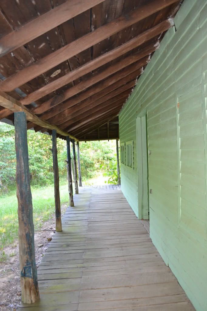
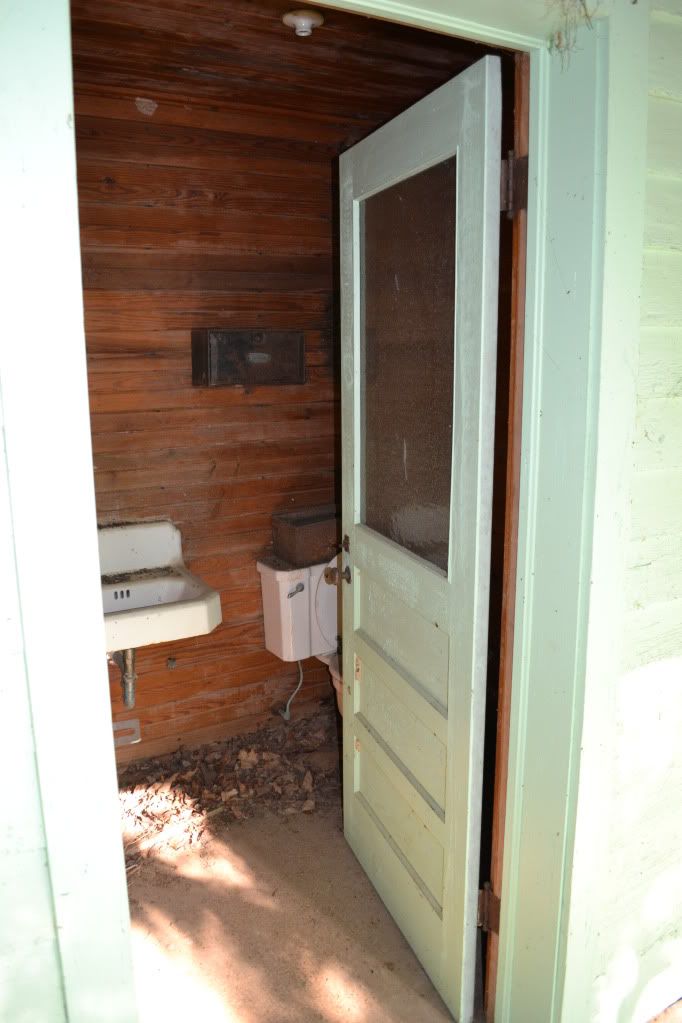
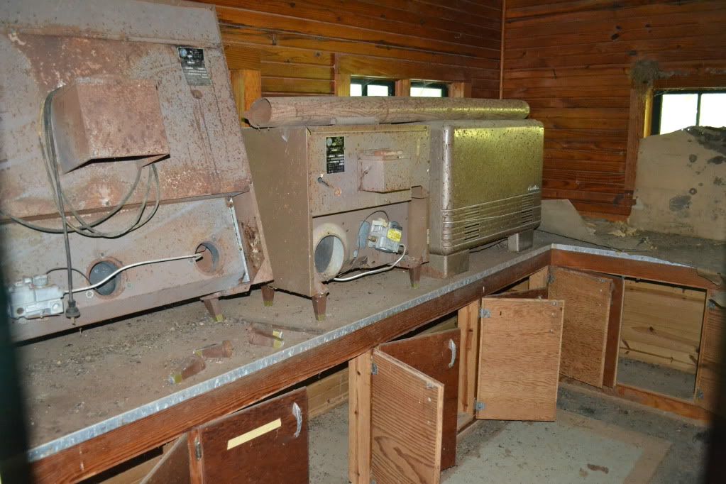
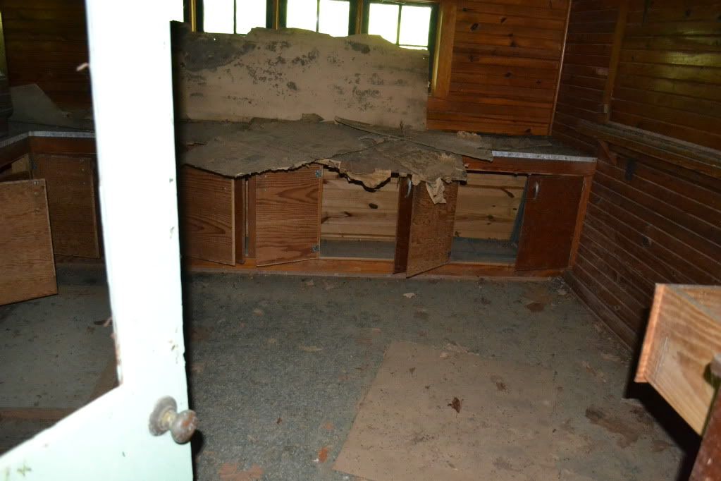
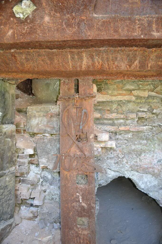
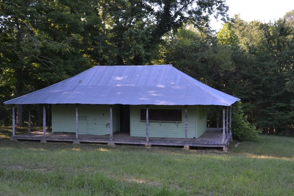
Upon arrival at the Collin's Homestead we first had to check out the ticket building.  Though the windows were shuttered the doors were wide open.  I poked into the ticketing office and quickly made a retreat...something in there smelled dead.  Very very dead.  In the dim light filtering through there appeared to be a couple odd looking bits of unidentifiable equipment and an old mattress on the floor.  Further around the other portion of the building were long out of use toilets.  Next we pressed our noses against the window glass of the house itself.  It is hard to imagine that a house of this size, only three or four rooms, once held 10 inhabitants.


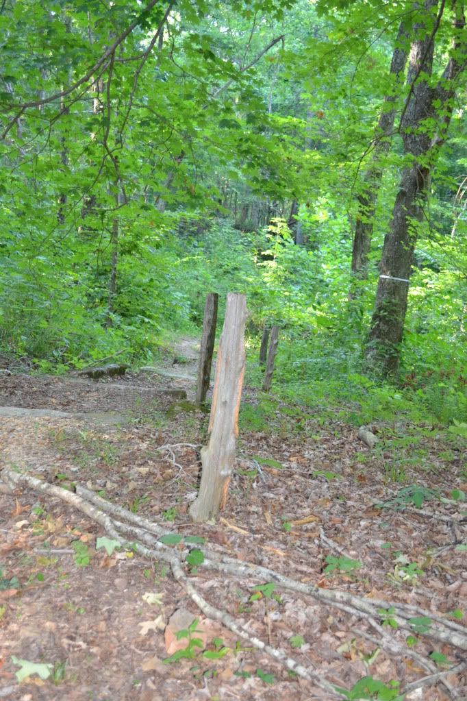
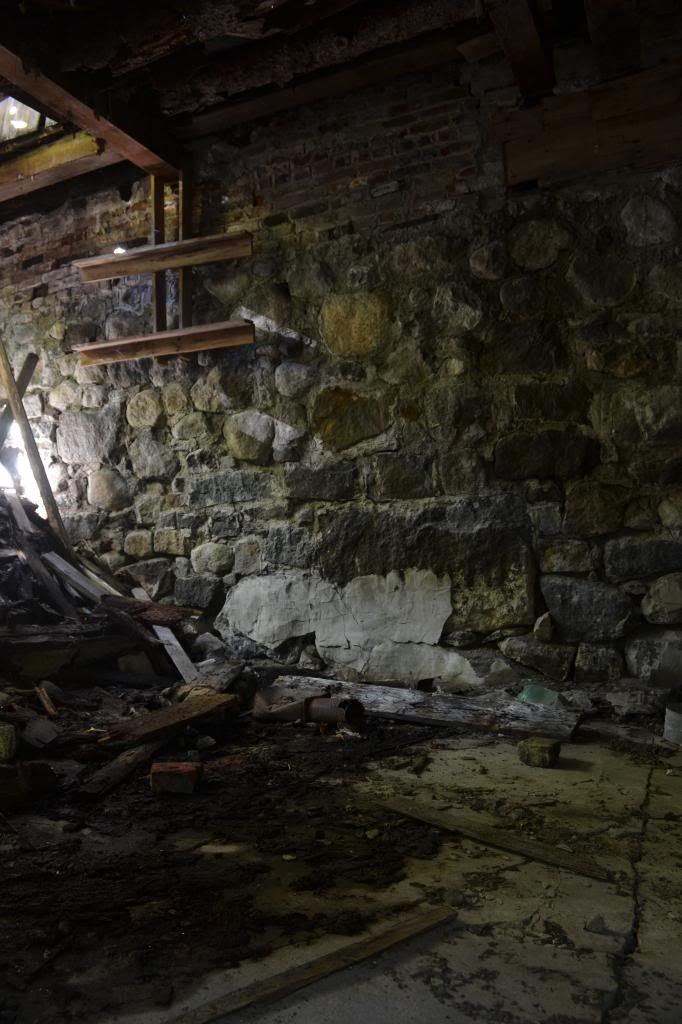
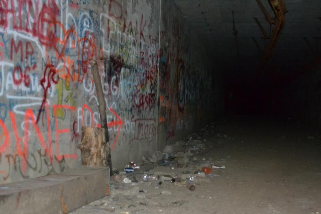
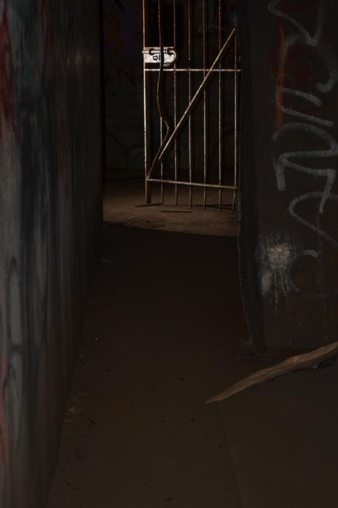
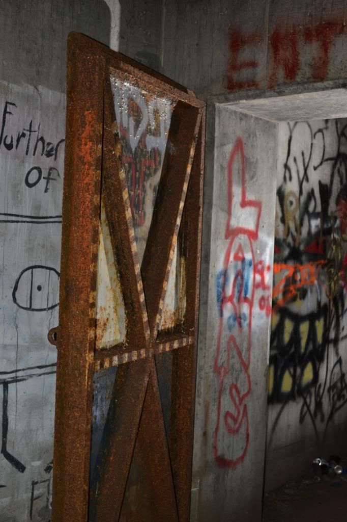
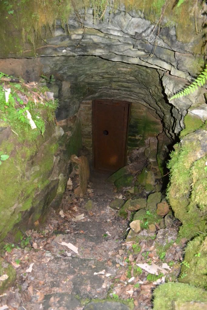
Between the house and the ticket building was a well worn trail leading down a hill.  This was definitely the trail down to the entrance of Crystal Cave.  The handrails are now gone, only a few of the supporting uprights exist now.  Th trail rounds the corner, and something very out of place confronts you...a red warning sign explaining that the cave is not to be entered.  We were not going to enter the cave however.  Aside from trespassing, it would be fruitless since we didn't bring any  gear.  The path continues down steps through some very beautiful ferns and columbine until we saw the quiet open mouth of the cave.  A few feet beyond where it starts to get dark is a steel door that halts further progress into the cave.

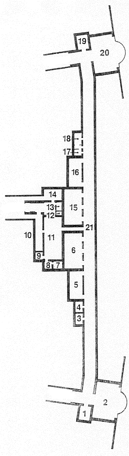
Amazing to think that in the not so distant past, this was the starting point for another epic journey that has been largely forgotten except by the caving community.  For, through that steel gated portal, many generations of cavers followed Floyd down the Valley of Decision to the Devil's Kitchen, left though the Gypsum Route to the Scotchman's Trap to where the cave REALLY begins, eventually leading through the bowels of Flint Ridge to the surrounding caves an eventually connecting to Mammoth Cave, making the Mammoth Cave-Flint Ridge-Joppa Ridge System the longest cave in the world.


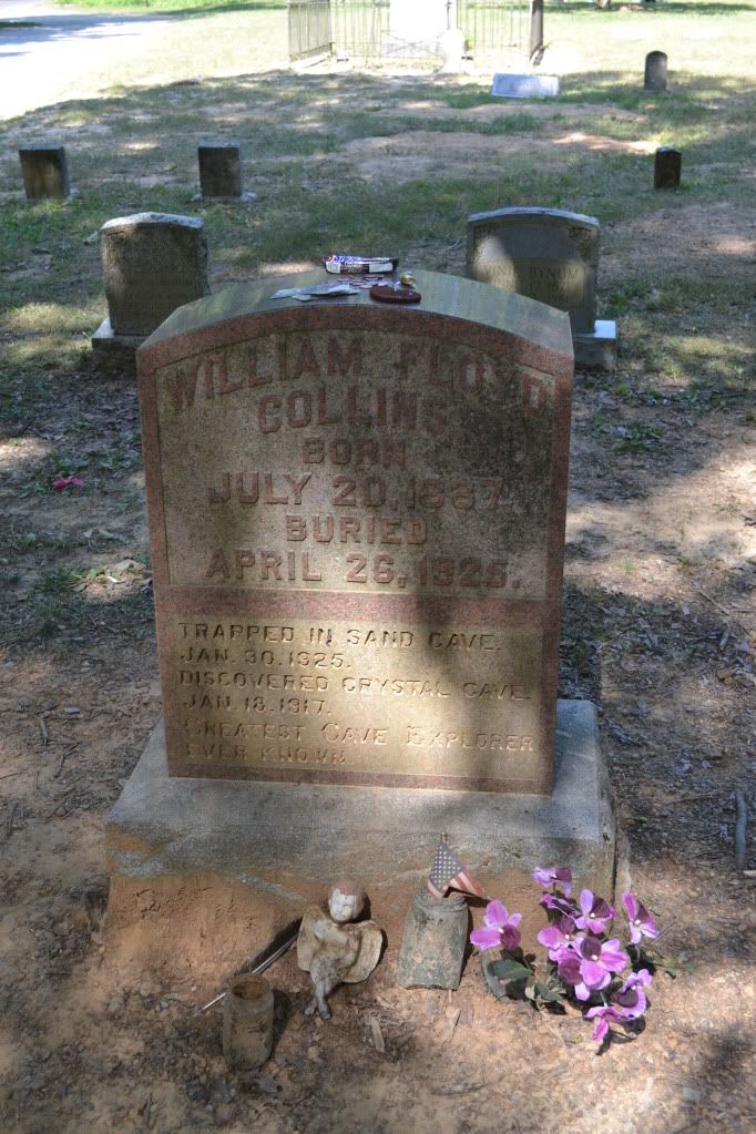
Floyd's Body was eventually laid to rest at the Flint Ridge Cemetery after having been on display in the cave he discovered, kidnapped from the cave he discovered and found tossed over a hill, re-interred in the cave and later put to rest next to his father and birth mother.  The headstone is remarkable for several reasons: the granite headstone is the original that was placed in the cave when he was buried, and secondly because it is lacking a date of death (post comments with what you think might be the reason for this).  When visiting the grave it has become customary for cavers to leave behind a small token of some sort.  I placed a Snickers bar on his grave which I am sure melted immediately in the 100° F + weather.  Just a little something for you there Floyd.


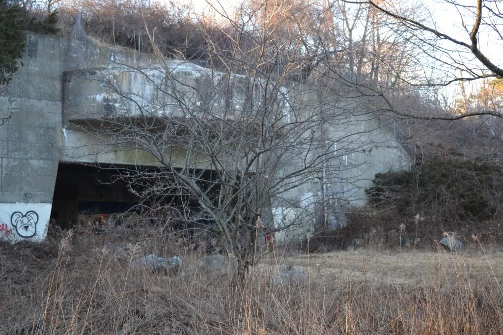
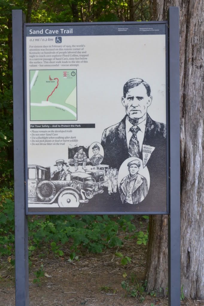
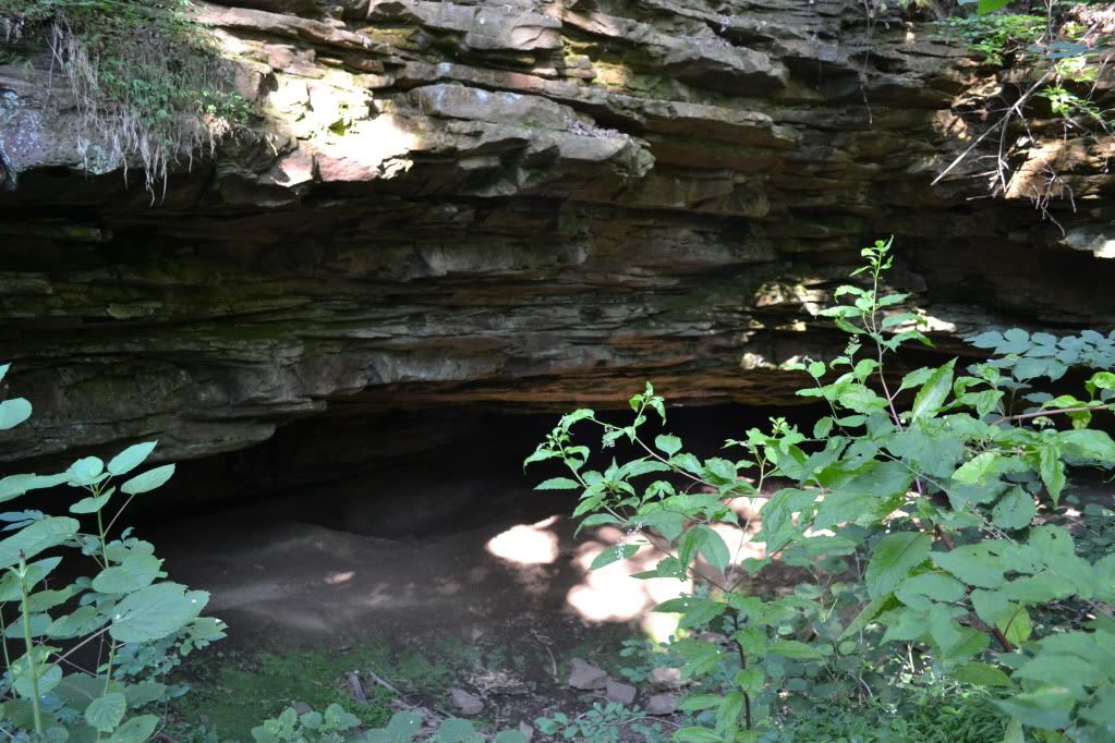
After visiting with Floyd we drove out to Sand Cave which is right at the Entrance to the Park.  The walk is wheelchair accessible via a boardwalk and is a pleasant walk through the wood.  The walk ends at a platform situated above the solemn and damp entrance to Sand Cave.  It is here that men laboured around the clock to save Floyd from the narrow passages below.  A faint path leads off the end of the boardwalk, over the upper edge of the entrance and then down natural steps to the entrance (this is off the official path, so stepping off is you assuming the risk of doing so).  My price of admission was the garbage I picked up along the way.  I took a moment standing in the summer light, the sound of water dripping from a hidden passage under the ledge above.


I would have stayed longer, but my scheduled tour for the Violet City Lantern Tour was about to begin.  It would prove to be one the the highlights of my trip to Mammoth Cave, so if you ever get the chance, I highly recommend the tour.  I also recommend taking the time to visit Sand Cave and the Flint Ridge Cemetery.  They are both very accessible pieces of history that has been largely forgotten by modern times, but back in the mid to late 1920's this was a story that was known well throughout the United States.

The song, performed by Vernon Dalhart is "The Death of Floyd Collins", is another piece of Americana that is not to be missed.

Please visit the website for more information about Mammoth Cave National Park, which is open year round for cavern tours.  Keep in mind that the tour schedule varies by season and during the busier times of the year tours can fill up very quickly, so online  reservations are recommended.  Solid and comfortable footwear is highly recommended as well as a sweatshirt or hoodie.  Walking to the Historic Entrance is surprisingly cool and windy...afterall, there are over 390 miles mapped of the known cave, that's a of air that moves when the weather changes.  Prices vary depending upon tours, but incredibly reasonable in comparison to the privately owned commercial caves.


Saturday, May 26, 2012

Lacklustre Experience with Bardo Farm


Tucked away in Croyden, an experiment has been unfolding for several years.  Labelled the Bardo Project, this small collective is not only an experiment in self-sustaining agro-business but also a social experiment.  While attending the Northeastern Regional Organization of the NSS (National Speleological Society) Spring gathering, the catered buffet of a Pig Roast was provided by the Bardo Project.  We were one of the last groups to return from our caving adventures, and over heaping plates covered in stuffing and organically raised roasted pig cooked to perfection, we chatted up the folks from the farm.  In between mouth fulls, we were told about the yearly farm festival taking place in Croyden over Memorial Day Weekend and invited to attend.  Being one to support local business, how could I resist?


After a hassle-free on-line reservation the night before, Heidi and I arrived at Bardo Farm around 10:45 am.  The folks at the registration booth were super nice and informative, and gave an over view of the events of the day, and explained that the farm festival actually covers four days, starting Friday night.  Following the map, we found plenty of parking and the main event area just as some Tom Waits was blaring over the PA (I was beginning to think that this was my kind of event!  Organically raised food AND Tom Waits...I was sure I was in heaven). Dee and I looked over today's list of events which included: Piglet Castration, Forestry Management, Raising Pigs, Pig Harvest, Wilderness Survival: Shelter Building, Solar and Off-the-Grid Energy to name a few.


After Realizing that we had quite some time to kill before the Shelter Building Workshop, we decided to go and check out the animals since they were pretty central to the events of the entire weekend.  Ok, so a few things that we learned:  1)Yes pigs smell, 2) I don't care what anyone says, piglets are just so damned cute, 3)chickens and ducks get along just fine, 4) Piglets like paparazzi, 5)to become best friends with a goat, feed it dandelions.


 After getting our fill of the animal fun, we wound our way back to the event area and attended a meeting of SOLE (Society of Libertarian Entrepreneurs).  This is where we discovered the more political side of the Bardo Project.  Now, I am by no means supporting nor condemning a particular political party...as someone who claims themselves independent of any particular political creed I could not since I firmly believe people are entitled to their own opinions and it is not for me to judge.


An announcement came over the PA informing everyone of the events starting at one o'clock.  This included Reloading (ammo) and the Wilderness Survival: Shelter Building Workshop.  Dee and I assembled at the appropriate area which happened to be where the reloading workshop was also meeting, and this is where things just fell apart for us.  The gentleman doing the reloading demo asked us which event we were waiting for, after after telling him it was the shelter workshop, he winced and then proceeded to completely ignore us, a Pied-Piper leading off a hand full of people without a word whether or not someone was coming to lead the other workshop.  We stood and waited for a bit, and finally realizing no-one was coming, we went home.

The event was generally not well organized.  Aside from the people at the registration booth, the only person who even made an attempt to converse with us was a red-haired gentleman at the goat pen.  Few attempts at conversation were made.  We were definitely the outsiders here.  This is in stark contrast with the statement made by one of the registration hosts which was to the effect that the people at the farm are accepting of just about everyone.

The most meaningful experience we had was with a couple who were also leaving.  They were visiting the farm with their infant.  We grumbled about our experience with the farm, and mentioned that we have eventual plans to homestead...raising our own animals and produce to sustain ourselves and barter with our friends and neighbours, and they said that they had the same goal.  After talking with them for a few moments we learned that they are trying to sell their home in NYC to move to New Hampshire, but they want to be close to Manchester and Concord as well as an easy commute back to the city since the husband has a strong sense of activism.  Finally, a genuine conversation with folks who were there for the same reason as us introduced themselves, shook our hands and took the time to find out a little bit of what we were about.

Its a shame that this was our experience with Bardo.  It seems like an interesting idea, and movements such as a social and agro-collective is something that, no matter what their political creed, I fully support.  Had our experience with Bardo been on more of a one-on-one basis, it would likely have been better.  Also, bear in mind that this is the second or third year that the Farm Festival has taken place and the attendance apparently was not as good as expected.  I'll give Bardo Farmfestival 2013 a shot.

For more information about Bardo Farm please visit their website: http://bardo.drupalgardens