
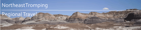
So, I know that this blog is dedicated to mostly travel and exploring the North East, however on occasion, thanks to my job, I get to do some travel outside of my favourite geographical area. So, I had the opportunity to work in one of our locations in Phoenix, Arizona. Never having been to Arizona, I was really looking forward to getting out into the desert, and my first choice of places to go hiking was at the South Rim of the Grand Canyon. Dessert usually equals abundant sunshine and heat, right?
Not on this day. Saturday, April the 18th we knew was going to be interesting. Though the temps in the city of Phoenix were forecasted to be in the upper sixties, it was going to be raining like hell. My co-worker J and I left the hotel around 6:30 am and started heading north on I-17 in driving rain and some wind, only to find just around Prescott that the rain changed to a steady wet snow. But, we live in New England where people will drive in twelve inches of snow just to get to the mall without giving a second thought.
When we reached I-40 out of Flagstaff, the snow backed off and everything appeared that it would be ok. We took our exit to get to the National Park, and as soon as we hit the border of the park, the snow came back in with a mix of rain for good measure. Finally arriving at the Visitor’s Centre, we discovered that we were going to need some extra clothing for comfort, so we made the trip to the trading post one mile away from the rim, unintentionally getting the same rain pants and similar outer shells making us look like either cult members or people from a running team. But it was good that we stopped in, as the clerk who helped us out gave us a suggestion of a hike into the canyon. He recommended South Kaibab trail to Cedar Ridge, explaining that the views, of which there were none due to the weather, are better than Bright Angel and that there is less foot traffic.
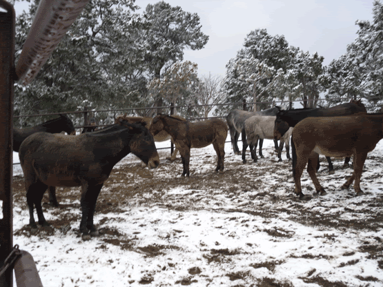
So, after returning to the Visitor’s Centre we caught the bus to the South Kaibab trail-head at about 7,000 feet in elevation (my first time hiking at a higher altitude than Mount Washington which is the highest point in the North East. At the trail-head there is a mule team used to bring supplies down into the bottom of the canyon, and as a word of warning while on the trail, get out of the way of the mule team as they go down or up, and also watch your step as there is a significant amount of mule poo.
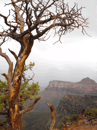
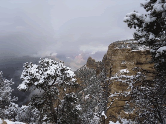
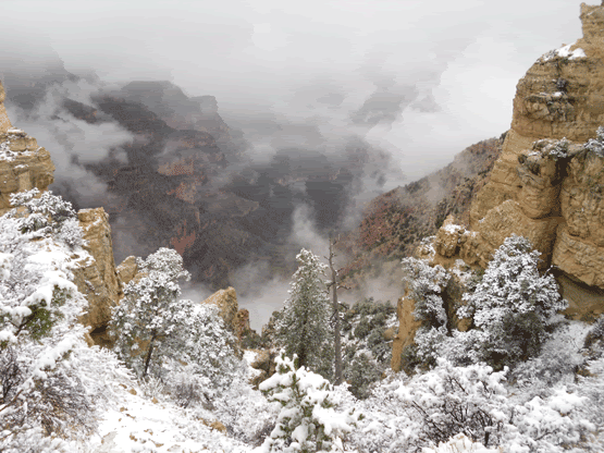
My first thought was how much it was going to suck not being able to see much in the way of views. To visit such an iconic part of the western American landscape and not be able to see the classic sights that so many before us had seen, but then again, how often does an easterner get to hike the Grand Canyon AND can see that they have seen it frosted with snow. I began to cheer up a bit at this though. Interestingly enough, every half hour to forty-five minutes the snow and rain would back off and the fog would lift just enough to begin to see the true scope of the landscape we had entered. Kind of like those first moments that you open your eyes from sleep and not quite everything is in focus. Bands of red rock, darker bands almost black, the trail nothing more than a red-clayed path leading further down, and then across the void barely glimpsing the opposite wall through atmospheric haze…then once again the rain and snow came back obscuring everything like some long and somber dream.
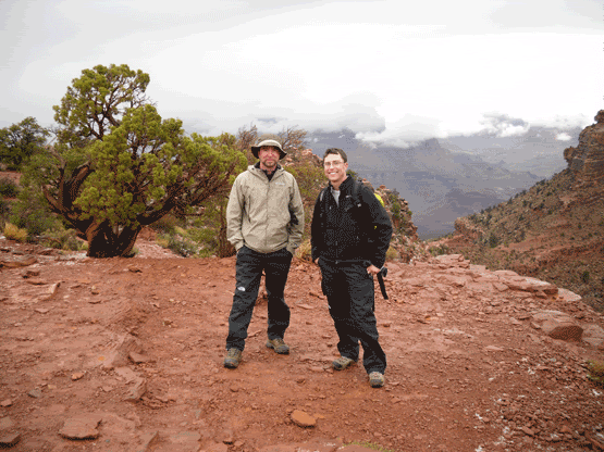
We encountered a few people on the way down into the canyon, most on their way back up, some carrying heavier loads from a backpacking trip from the day or week before. After about two hours worth of hiking we finally reached our intended destination, 2,000 feet below the rim at Cedar Ridge, a broad plateau overlooking the Colorado River (which try as we might, never did get to see). There were a few educational displays, and the chemical toilets were a welcome sight. Here there were, as the name suggests cedar trees as well as the dead dried-out stalks of yucca and dried shrubs.

Finally it was here that blue sky and the sun began to peek through, and standing on the edge, through the haze we could see only mile after mile of buttes, mesas, and the maze-work of streams thousands of feet below that have sculpted the red rock into one of the most incredible sights man has ever laid eyes on.

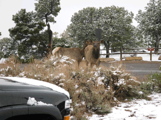
After the hike up and out, we were greeted by a small herd of Mule Deer just hanging out by the cars at the trail head. We were able to get surprisingly close (though we decided to not get too close. Snapped a few pictures. After the short bus ride back to the Visitors’ Centre where we parked, we could hear thunder rolling in the distance and got the eerie treat of listening to the thunder echo through the canyon. Simply incredible. So, here is the list of weather we got to experience:
- Rain
- Snow
- Hail
- Sleet
- Thunderstorm
- Sunshine
It was time to return to the hotel and catch up with the rest of our crew for the Big Unit Challenge at Cooperstown in Phoenix.
The South Rim of the Grand Canyon is open year round, and can be easily reached from Phoenix, AZ by taking I-17 North to I-40 West. Take the exit for I-64 West and follow this to the South Rim entrance to the Grand Canyon. For more information and directions visit the National Park Service website http://www.nps.gov/grca/

No comments:
Post a Comment