Compared to neighbouring Maine and Massachusetts, New Hampshire has only fourteen miles of coastline, the major port of the area being in Portsmouth. The deep waters of Portsmouth harbour makes for a superb location for the Portsmouth Naval Shipyard and its dedicated men and women who service military ships and submarines. Because this was such a strategic point for our national defense, throughout history many forts have been built to protect these waters: Fort Constitution in New Castle, Fort McClary and Fort Foster to name a few.
On Odiorne Point, just south of Portsmouth is Fort Dearborn. During WWI a temporary fire control station was constructed on Odiorne Point in 1917 for Battery Hunter at Fort Stark, located on the nearby island of New Castle; a year later the temporary battery was removed.

With the arrival of WWII it was determined that our coastline was at risk of attack from the Germans and our strategic deep water ports must be protected. The farmland of Odiorne Point was purchased and Fort Dearborn joined the ranks of other forts that ran from Maine to South Carolina as part of the Atlantic Seacoast Defense System. The stretch that most people drive to get a view of the scenic coastline and stately mansions of Rt. 1A was shut down and only used by military personnel. On April 18th, 1942 Battery 103, also known as Battery Seaman was constructed on Odiorne Point. According to some research on the area the giant guns that were placed in the two casements of Battery Seaman were fired only once as a test and caused windows in nearby Portsmouth to shatter. In 1948 the Battery was deactivated and in 1949 declared surplus property eventually coming into ownership of the state and later turned into Odiorne Point State Park.
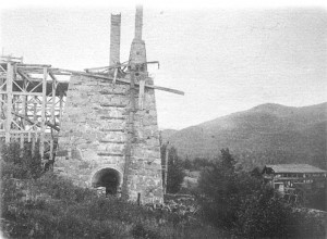
Photo from www,northamericanforts.com
Several of these old buildings are still in existence, unknown to me until just over a year ago when my partner Heidi and I were talking about our mutual love of abandoned structures. She had mentioned that her brother and a couple friends of his had actually gone inside of one of the casements (there are several still in existence, most are not accessible for clear and obvious reasons but they had gone inside of Battery Seaman to use as a setting for one of their amateur films). I had been visiting Odiorne Point for several years and knew of the old foundations used for some guns but I never knew anything about the other structures. A trip had to be made out to it!
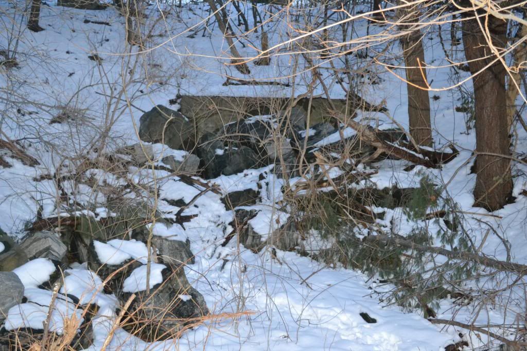
Upon our arrival we took a trail that I had never been on before through the woods north of the visitors' center for the Seacoast Science Museum. After turning down several trails we came to the first concrete structure. This was a look-out or observation building of some sort. It is currently covered in graffiti, some of it actually quite artistic though it is sad to see a piece of local military history treated like this. Dee lead me on to another series of trails and soon in the distance the looming hulk of another concrete structure appeared.
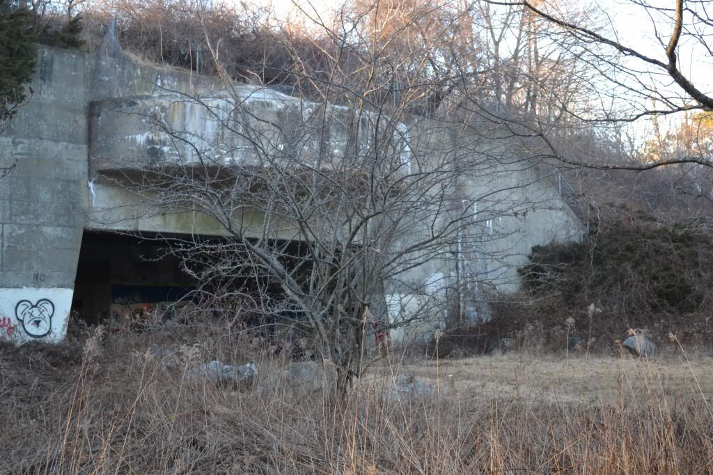
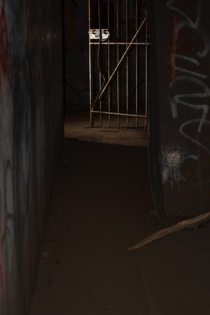
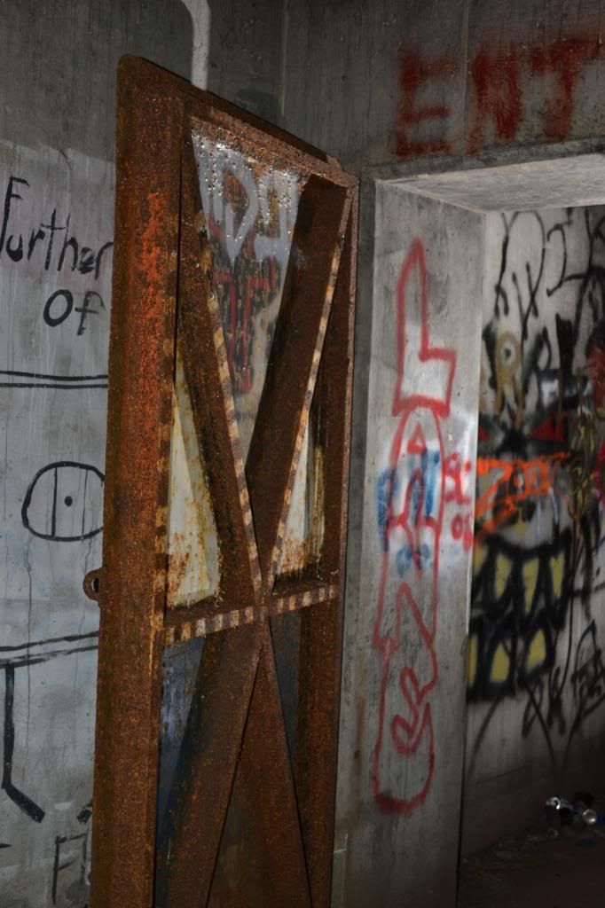
This was one of the cannon casements of Battery Seaman itself. Covered in artful graffiti as well and poetry, the scale of the structure is hard to discern as much of it resembles walking under an overpass with earth covering the majority of the structure. In the tunnel itself are two cast iron doors, one of which has been covered in successive layers of plate steel that have been cut through by people attempting to get inside. Though I poked my head through the gaping hole in the door I did not climb inside but did poke my camera through wherever I could to take photos.
I would save that for a later trip. We found that on the backside of the Battery a trail leading to the top of the earthen mound and found another concrete structure on the top, evidently another lookout, that was covered in even more lurid graffiti warning people to "Beware of Hobos" (something that I now take to heart in my town as there is a shanty-town of homeless drug addicts that live near the old rail yard). From the top of this hill are some additional trails, one leading you around a chain-link fence and takes you out onto the semi-circular concrete "roof" that the cannons were partially covered by. Here we had found evidence in the form of PBR cans of either hipsters or someone with poor taste in beer having been there before us. After returning to the bottom of this man-made hill we continued further north and came across the other casement of the second cannon. Inside of the similar underpass type structure was another plate steel door, this one not forced open. This was enough of a visit this time to wet my interest in finding out more about Battery Seaman and where it fit into the history of the area.
The brief account that I have given at the beginning of this episode of NET is the result of that research. Reviewing images from Google Earth doesn't readily give you a sense of the old structures as many have been removed or buried. Evidently the Command Centre of the Battery couldn't be housed in the Battery itself due to the vibration that would be caused by the guns. I also eventually found a map of the interior of the casement structure which consisted of several rooms and a long tunnel that connected the two casements. The Command Centre of the structure was located a distance away to the west of the Battery, something that we did not see on our initial visit to the area.
Photo on left from www.northmericanforts.com showing the interior structure of the Battery Seaman.
Last year, just prior to our attempt to document and map the passageways of Howe's Caverns (See "
How Cavers and a Commercial Cave Came Together to Help a Community") I purchased two slave units to fire flashes remotely for some cave photography, an admittedly difficult pursuit and needed to test them out ahead of time to get used to using them, and thought Battery Seaman would be the perfect environment to try them out. So one day, shortly after work, Dee and I headed out to Odiorne Point and Battery Seaman (armed with a hiking pole to fend off attack by any of those aforementioned "Hobos"). The evening was very foggy with the arrival of Spring-like temperatures as we arrived at the sullen concrete colossus. There were two other gentlemen there with a dog and flashlights poking there heads through the hole cut into the door, and after a brief exchange Dee and I climbed on in.

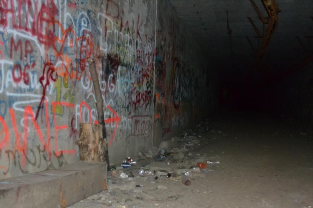
The first thing that hits you is the smell. Not sour or rotten, but of decay...not really that pleasant. The graffiti continues down the long corridor and there are piles of rubble and trash along the way. Just inside of the structure is the first of several rooms that you encounter. Most do not have anything inside besides graffiti and some trash.
To go any further in trying to describe the interior of the structure would be an exercise in tedium. There are very few artifacts that remain, the most major being the remains of some sort of machinery and duct-work. However, it is still interesting historically and it has kindled my interest in finding out more about our abandoned military structures that dot our coastline and the neighbouring coast of Maine. There is a lot of graffiti present throughout the entire site, while I do not condone adding graffiti to any site and will berate people that I see doing it, some of the artwork is very well done. I plan on returning to this site with some higher powered flashes to get better shots.
As with ANY site such as this, enter at your own risk. A dust mask would be a really good idea when visiting any of these military sites as you cannot be guaranteed that there are not any hazardous materials that could be inhaled (something that I thought long and hard about as I was walking around mask-less). Also, be aware that these structures are antiquated and have not had any form of stabilization and you cannot be guaranteed that things will not collapse. By entering any such structure you are assuming the risk. And also, please do not deface the site any further than it already has. This is a piece of our history that is slowly being lost either through decay or thoughtless defacement.
An update as of 03/09/2013
I finally located the Command Centre thanks to a wonderful iPhone app called Topo Maps (you can purchase it at
www.topomapsapp.com)! I did not enter the structure as I didn't come prepared to shoot with slave units and the tripod (it was a thirty minute hike in and out before the gates closed at the Seacoast Science Centre and it takes around fifteen minutes to get there from that entrance), but I will make the trip out there soon with the appropriate gear. But there are a few photos to wet your appetite.
To find out more there are several high quality sites to visit.
www.northamericanforts.com has been a great resource for the history, maps and the great image of the cannon firing. Much more information can be found there. Also
http://pubpages.unh.edu/~kap289/pages/dearborn.html is a great resource as well on some of the surrounding forts besides Fort Dearborn. All photographs taken are by me with exception of the cannon photograph and the map of the interior of Battery Seaman. Those rights remain with the owners of the American Forts website and have been used for illustrative purposes only. And if the military bunkers are not quite your thing, the
Seacoast Science Centre and the rest of Odiorne Point make for a great afternoon as well.