Tuesday, October 14, 2008

Dolly Sods, West Virginia


This is one of my favourite places on earth. My father is an avid gardener and backyard naturalist, and his beard is six times the size of mine. As a child we would frequent the area of Dolly Sods, a high plateau of very unusual geological features and what makes it even more unusual is its Canadian taiga plant life.


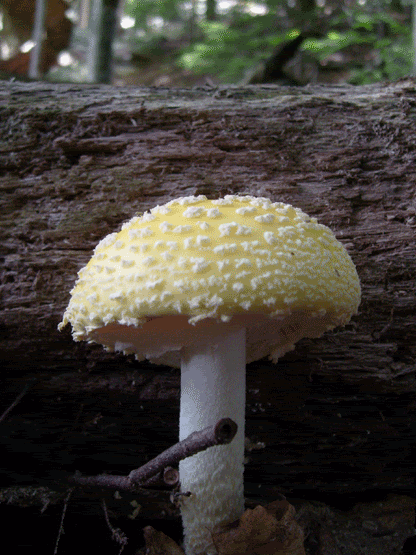
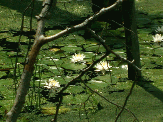
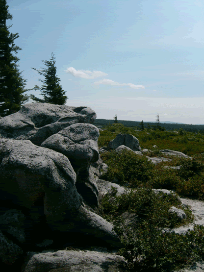
At one point this was the eastern most shore of the continent of North America, as is evidenced by the conglomerate rock (its kind of like concrete made of sandstone with large quartzite pebbles) and pure white quartz sand. The headwaters of Red Creek and its beloved hiking trail begin from the cranberry bogs where you can walk on top through marked trails on the spongy earth, and then descending through the Blue Spruce forest and a torrent of waterfalls. To make it even better, surrounding the bogs and the spruce trees is square mile after mile of wild blue berry bushes and they are free for the picking (I argue that West Virginia wild blue berries rival those of Maine and New Hampshire).

So, the day before I was to return northeast after my grandfather's funeral in Johnson City, TN my father suggested that we go to Dolly Sods. I don't know that I had ever been so excited to go, it had been about twelve years since I had been up there, and growing up this was my playground.

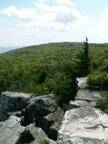
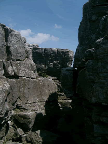
The sandstone is carved by wind and rain and the relentless volleys of winter, and looms like castle turrets from the undergrowth of blueberries. While most children were building forts in the woods in their back yards, I had these ready-made forts that could withstand the assault of pine cones, rocks and mud.


I showed pictures once to a friend of mine who lives in Volgograd, Russia. She referred to it as a dismal dreary place. It is true; the plateau does have its own peculiar sullen charm. Clouds can roll in a moments notice, a light drizzle, and a frigid wind. The air is even thinner, sound doesn't travel the same. Its beautiful and spooky at the same time.

This day however that my father and I went to pick blue berries was far from dreary but yet brutal from the sun. I spent a good three hours picking blue berries (I got half a gallon to bring back home) before I realized my sun burn was going to be bad. Really bad. So, while wandering, I found a neat little hollow and saw something brittle and white. I found bleaching deer bones, skull, ribs and vertebrae, likely the victim of the weather and then scavenged by coyotes. Then I made my way to the precipice of Bear Rocks, attempting to find a little shelter from the sun in the many crevices and boulder caves that I used to crawl and climb through as a kid.


The Dolly Sods Wilderness area is free of charge, and is located on Rt. 55 near Elkins, West Virginia in the Monongahela National Forest. It offers spectacular scenery, hiking, wilderness backpacking, groomed camping areas for those who don't wish to "rough it", and just abundant West Virginia wilderness that is simply unrivaled. More specific directions can be found on the Wilderness area's website http://www.fs.fed.us/r9/mnf/sp/dolly_sods_wilderness.htm. I strongly suggest sturdy shoes, and dress appropriately for the season. Even in summer the temperature difference between the bottom at nearby Smoke Hole Caverns (another cool spot to visit) and the top of the escarpment can be significant. Other nearby areas of interest are Spruce Knob, Germany Valley (excellent caving), the world class climbers' spot Senneca Rocks, and much much more.

Morris Cave, Vermont


Situated about 16 miles south of Rutland, Vermont in the hamlet of Danby Four Corners, tucked away in a secret lime quarry is the third longest cave in Vermont. I frequented Morris Cave with my non-biological brother throughout college in Poultney, VT (one hell of a drive away from the cave). Often going in as soon as classes finished around four and not returning until well after sun down.


On the way back from the trip to Clarksville this past weekend, we made a detour to take a leisurely drive back through Vermont, avoiding the hell that is I-90 on Columbus Day weekend. The fall foliage was absolutely spectacular! I suggested at least going up to the cave entrance just to take a gander at it since it had been about ten years since I had smelled Morris' cool refreshing breath.


 Tucked away in a small lime quarry that is now abandoned, the gaping maw in the side of the cliff is misleading. Yes the cave entrance is there, but if you had visions of an easy entrance you will be sorely disappointed. To the left is a hole, apparently bored out of the marble that the cave is formed in. Going in feet first, you drop about three feet to the ground, and prepare yourself to leave the standing position for the next 200 or so yards. Though very little is a belly crawl, the passage takes an incredible 45° dip downward as you slide over a mixture of cobbles and bedrock. Then you encounter the first pinch, a wide but very low scoot through on your belly. Rotund folks may want to reconsider going any further as you will be doing this two more times, each pinch becoming more constrictive. The last pinch, called the "U Tube" (not to be confused with the popular video website), is the smallest, barely allowing the shoulders to pass, and being the shortest of the pinches, you reach the "Changing Room", a stand up area that has a sizable block of breakdown almost blocking the passage. Crawling over this, you reach nirvana...the ceiling soars 40 to 60 feet above you. What this cave lacks in formations (what very few have already be stripped by vandals) you get something else quite incredible instead. The smooth eroded marble has incredible bands of colour; browns, tans, greys, whites and black swirl around you. From your first entrance to the largest room of the cave, you can continue down the hill to the 40° F lake that is probably the most frequent source of virgin passage if you are brave enough to dive its murky depths. From the Changing Room, if you continue straight, the passage terminates in the 27 foot deep Cork Screw. However, by far the most intriguing portion of the cave to me is the Water Falls Passage and it is very tricky to find. Look for a small stream that suddenly disappears into an unassuming hole in the floor. Work your feet into this hole, lie down, let the stream trickle cold water down your spine and follow the water. This small space finally opens up into a dryish dusty hands-and-knees crawl. After a short distance, you can hear the water rushing somewhere behind a wall and the floor. Finally you encounter the Water Falls Passage, with so much iron precipitating out of the stream that you can smell and taste it. To the left is the source of the water (I have only be part way up, and I have heard horror stories from Boston Grotto members who have lost the seat of their britches climbing up it). To the right the water enters a pool that sumps to the ceiling.

Now, I have some very fundamental questions to ask. Firstly, I know water table is a bit below. Secondly, I am pretty sure that because of the tilt of the stone, the marbles sit on top of the limestone underneath (it all got turned over when the mountains lifted). The sump appears to be caused by a thin layer of shale (more insoluble that marble or limestone). But all that water is going somewhere. Where the hell is it going?

As with any wild cave, all visitors need to be very careful. A cave is only as dangerous as the explorer makes it. They have inherent dangers, that is a given, but if you come prepared and you move cautiously, with purpose, you will likely have a good experience. I cannot stress enough the importance of this. For tips and more information you may want to check out the National Speleological Society website on safety and techniques http://www.caves.org/safety/index.shtml.


Monday, October 13, 2008

Pawtuckaway Boulder Fields


Located in Nottingham, New Hampshire is a phenomenal and not very well known gem called Pawtuckaway State Park. I frequent the area on a regular basis during the late spring and summer months in search of its native orchids (especially Goodyera pubescense), to roam among the boulder fields, rappelling from the Lower Ledge much to the irritation of the rock climbers who feel that they have some sort of superiority over everyone else who wishes to practice the vertical arts, and I just recently located the Devil's Den heading toward the peak of North Mountain.

First of all, and I have to put this as a byline for visiting Pawtuckaway State Park, because I like to go into the less public area (which for now is free unlike the main entrance if you want to go swimming or fishing at Pawtuckaway Lake), please be aware that the road off of Reservation Road is very rough and must be driven slowly. Also, please be aware that it is quite possible that you will lose a tire just as I did shortly before I left for Washington, DC for a week. The locals and other people who feel that because they drive a four-wheel drive vehicle like to drive at a pace that can only be described as reckless, as is evidence by how rutted and torn up the road is. Drive slowly and patiently, please.


The Boulder Field is my favourite place to visit. A glacial cirque that developed as the glaciers tore down the walls of one of the few volcanic mountains in the area, and secondary growth of oak, maple and hemlock trees, the paths are winding and shady, sheltering an incredible variety of mushrooms both edible and poisonous, racing snakes, small rodents and marshland perfect for watching predatory birds, Great Blue Herons and a choir of frogs, this place is captivating, relaxing and well worth the visit.


If you are into the adventure aspect, the boulders offer some convenient and top class climbing, and the lower ledge, a massif of rock overlooking Dead Pond soars 65 feet above a pine needle floor. A trail leading off from the Boulder Field winds its way toward the sullen peak of North Mountain, where right before you start the more serious ascent, the gaping maw of the shelter cave called Devil's Den offers the hiker the opportunity to relax in the cool breath of the mountain as it escapes from somewhere in its depths.

For a map and directions, visit http://www.nhstateparks.com/paw.html

Howe Caverns


On my way back and forth between Vermont and Virginia, on the desolation known as I-88 that takes you from Albany to Binghamton, NY I had often seen the white stone lettering on a green hillside advertising the location of Howe Caverns (I even went to college with a girl who was a tour guide there), and we decided that we could possibly fit just one more cave into the day.

After a mishap of mental perception of where exactly we were in relation to I-90, and going 27 miles out of our way south on I-87 when in fact we should have gone north on I-87, we finally arrived at Howe Caverns. On the way up, we were entertained by signs advertising Secret Caverns, "we're cheaper", "You'll flip for Secret Caverns", we were not quite tempted enough to divert from our intended course.

Howe Caverns was discovered by Lester Howe in 1842 with the help of his cattle who would congregate on the hillside around a particular bush. After inspection of the area Lester pulled up the bush and discovered a gaping hole and decided to capitalize on the discovery by making it a tour cave. But after not being a successful venture, the cave was bought by a quarrying company who started destroying the cave (typical, I can tell you of the crimes committed by several quarrying operations against caves in West Virginia). Appalled at the destruction of the cave, a corporation purchased the cave from the quarry, and has since then operated the cavern as a tourist attraction.


First of all, this cave feels cold, very cold though it is advertised as being 52° F, so bring a light jacket. A stream, the aptly named River Styx runs for almost its entire length. You start at the deepest portion of the cave, at 159 feet deep from the peak of the hill as you head toward the original entrance. It is a half mile walk through long galleries sparsely decorated with your typical cave formations of stalactites, stalagmites, columns, flowstone, drapery and some occasional rimstone. Some even have fanciful names such as Godzilla.


The further you travel into the stygian depths you finally reach, what was for me, the highlight of the tour, a 1 quarter mile boat ride. Our boatman, bearing no resemblance to Charon (the boatman of the river Styx in Greek mythology), even serenaded us with his rendition of "That's Amore". On the boat ride you must mind your head, as the ceiling does on occasion drop fairly low. After returning from your boat ride, you go the bridal alter, a carved piece of translucent calcite embedded into the floor, and a really cool gallery called "The Winding Way", before returning to the surface.


Howe Caverns are located off of I-88 from exit 22, and then take route 7 east following the signs. The regular tour costs $18 for an adult ticket. Visit http://www.howecaverns.com for more information.

Clarksville and Ladder-Dig Caves, NY


Located in the eastern foothills of the Adirondacks, about a 16 mile drive from the NY State capital of Albany, sits the small quiet town of Clarksville, New York. Here, beneath the town sits probably one of the most popular caves in New York. Clarksville is not a large cave by Virginia and West Virginia standards, but at just around 4,000 feet of known length, it is the second largest in Albany County.


Managed by the Northeastern Cave Conservancy http://www.necaveconservancy.org, this cave is generally open to the public provided that you travel with a group of no less than three people, each of you must have three sources of light, and that you are dressed appropriately for the cave.

We arrived at Clarksville Caves, also known as Ward-Gregory Cave, around 7:00 in the morning when the property officially opens. The sun was still not completely up yet, and the only other sound beyond the shuffling through leaves by our feet was from squirrels stashing the abundant acorns for their winter pantry. Upon arrival at the sink-hole, a depression in the ground caused by the collapse of a chamber underneath, and double checking our gear, I led the way in noting a fairly strong air current exiting the cave. The drop to the floor of the Big Room is around fifteen feet down a slightly muddy slope of breakdown worn smooth by the numerous visitors over the years. We decided that we were going to visit the northern trending passage of Perry Avenue since this is the most easily accessible portion of the cave. The southern Ward portion of the cave is entered from the main sink through a series of tight belly crawls that can be considered tight for the initiate to caving. After a quick check with a compass, we headed for the sound of flowing water.

Perry Avenue is mostly walking, with occasional moments when one needs to walk stopped over when the ceiling drops low enough. A stream winds through much of it, and in places one must choose whether or not they want to slog through the ankle deep water, or take the high-ground as they head north to the Lake Room. The water is about 48° F, so as often as possible I suggest taking the high-ground unless you are armed with set-suit socks (which we had, it makes a real difference when your feet are kept warm).


Perry Avenue
 
The furthest north we made it was just before the Petroglyph Crawl, where over the years people had carved their initials and the dates of their visit into the rock. Many date from the late 1800's to the early 1900's. It is important to note that the act of carving your initials into the rock is now considered in bad taste as it defaces the cave, and if caught you are likely to get a serious tongue lashing or possible find yourself in a court of law since it is now illegal to do this.

There are few formations of note in Clarksville cave, due either to re-erosion when the cave flooded (as it periodically does), or because of theft. My guess is that the cave is geologically very young, or its development was severely slowed when the area was under nearly a mile of ice during the last ice-age.

In very close proximity to Clarksville Cave is the aptly named Ladder-Dig cave, a large crack in the ground that has a make-shift but sturdy ladder leading 27 feet into its depths. The cave at one point was partially filled with rubble and garbage that people dropped in there. Now partially excavated, there are small crawl-ways that await further excavation, and some have formations as this portion doesn't seem to flood, and also apparently doesn't connect to Clarksville.


Ladder-Dig entrance

We lowered ourselves down inside, and no one else was apparently adventurous enough to crawl through on their bellies, so I went on ahead, keeping within earshot. In the north trending passage I found a stand-up area and a little nook with formations. After snapping some photos, I returned to the entrance pit and headed down the south trending passage that was significantly tighter and had tree roots growing through. The air was thick, so I turned back.


formation in Ladder-Dig


Looking out from bottom of Ladder-Dig


We re-entered Clarksville Cave once more after lunch, and after getting a distance down Perry Avenue again, we heard voices and saw a few lights. After having the preserve to ourselves for almost the entire morning, we finally encountered a couple headed toward the Lake Room. In conversation with them, they mentioned that a group of 15 people were on their way in, so we decided it was time to leave. By 11:30, we were back on road to head to Howes Caverns, a commercial cave 35 miles away in nearby Schoharie County.

For more information and history of the Clarksville Cave Preserve, please visit the Northeastern Cave Preserve website http://www.necaveconservancy.org. It has alot of great information and photos and maps as well.